
About this app
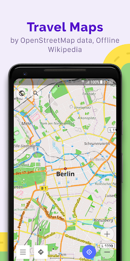
OsmAnd is an offline world map application based on OpenStreetMap (OSM), which allows you to navigate taking into account the preferred roads and vehicle dimensions. Plan routes based on inclines and record GPX tracks without an internet connection.
OsmAnd is an open source app. We do not collect user data and you decide what data the app will have access to.
Main features:
Map view
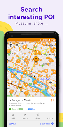
• Choice of places to be displayed on the map: attractions, food, health and more;
• Search for places by address, name, coordinates, or category;
• Map styles for the convenience of different activities: touring view, nautical map, winter and ski, topographic, desert, off-road, and others;
• Shading relief and plug-in contour lines;
• Ability to overlay different sources of maps on top of each other;
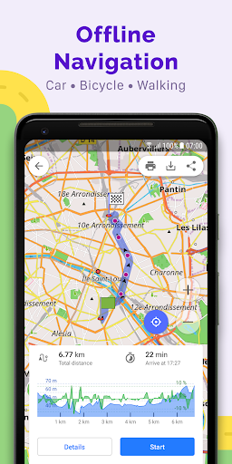
GPS Navigation
• Plotting a route to a place without an Internet connection;
• Customizable navigation profiles for different vehicles: cars, motorcycles, bicycles, 4x4, pedestrians, boats, public transport, and more;
• Change the constructed route, taking into account the exclusion of certain roads or road surfaces;
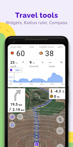
• Customizable information widgets about the route: distance, speed, remaining travel time, distance to turn, and more;
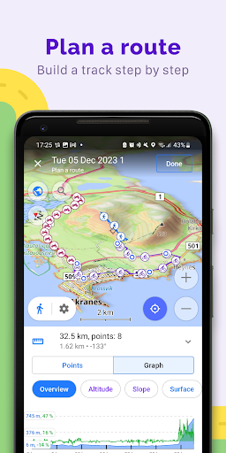
Route Planning and Recording
• Plotting a route point by point using one or multiple navigation profiles;
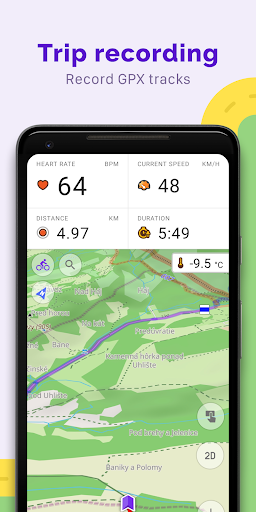
• Route recording using GPX tracks;
• Manage GPX tracks: displaying your own or imported GPX tracks on the map, navigating through them;
• Visual data about the route - descents/ascents, distances;
• Ability to share GPX track in OpenStreetMap;
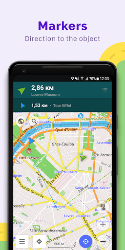
Creation of points with different functionality
• Favourites;
• Markers;
• Audio/video notes;
OpenStreetMap
• Making edits to OSM;
• Updating maps with a frequency of up to one hour;
Additional features
• Compass and radius ruler;
• Mapillary interface;
• Night theme;
• Wikipedia;
• Large community of users around the world, documentation, and support;
Paid features:
Maps+ (in-app or subscription)
• Android Auto support;
• Unlimited map downloads;
• Topo data (Contour lines and Terrain);
• Nautical depths;
• Offline Wikipedia;
• Offline Wikivoyage - Travel guides.
OsmAnd Pro (subscription)
• OsmAnd Cloud (backup and restore);
• Cross-platform;
• Hourly map updates;
• Weather plugin;
• Elevation widget;
• Customise route line;
• External sensors support (ANT+, Bluetooth);
• Online Elevation profile.
Downloads
1.2.3.4.5.6.7.8.9.0
LATEST
01/14/2023
Download
326.65 MB
1.2.3.4.5.6.7.8.9.0
LATEST01/14/2023
Supported Architectures
MD5 Checksum
971d7ddec7958a5ae75d2b179f93c3b4
Minimum SDK Version
23
Version Code
4306
Upload Date
Jan 14, 2023, 1:41:10 AM
1.2.3.4.5.6.7.8.9.0
02/29/2020
Download
78.35 MB
1.2.3.4.5.6.7.8.9.0
02/29/2020
Supported Architectures
MD5 Checksum
eb9a9afe0dd645b5176e46224a97e5b0
Minimum SDK Version
15
Version Code
363
Upload Date
Feb 29, 2020, 7:17:50 PM
Similar Apps
Brooklyn Bridge NYC Audio Tour
5.0
everyone
Visit Jim Thorpe PA
5.0
everyone
#tomsriverlocal
5.0
everyone
Valley Forge GPS Audio Tour
5.0
everyone
Grabaseat
5.0
everyone
Myrtle Beach Travel Park
5.0
everyone
Cleveland Historical
5.0
everyone
Explore Baltimore Heritage
5.0
everyone
Lake George RV Park
5.0
everyone
Try Parking It
5.0
teen