About this app
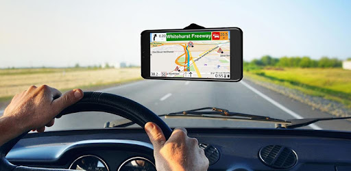
Find the best route to your destination even without an internet connection. Magic Earth uses OpenStreetMap data and a powerful search engine to offer you the optimal routes for driving, biking, hiking and public transportation.
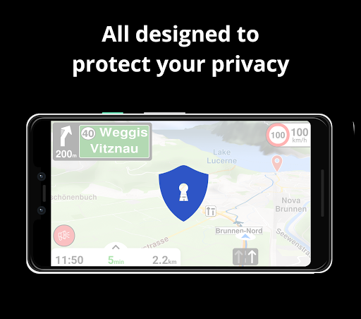
PRIVACY FIRST!
• We do not track you. We do not profile you. We do not trade in your personal data; moreover, we do not have it.
MAPS
• Save big on mobile internet costs and navigate reliably with offline maps powered by OpenStreetMap. 233 countries and regions are ready to be downloaded.
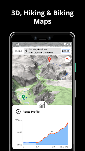
• Choose between 2D, 3D and Satellite map views.
• Get ready for travel and know every detail of your route like surface, difficulty, distance and elevation profile.
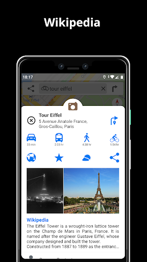
• Learn more about the points of interest near you from Wikipedia articles.
• Spot nearby parking places to easily park your car.
• Stay up-to-date and enjoy regular free map updates.
AI DASHCAM
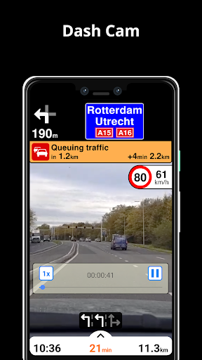
• Improve safe driving and avoid accidents. Receive alerts to potential problems on the road and record your trip.
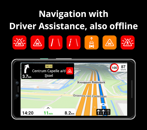
• AI DashCam features Driver Assistance warnings and Dash Cam functionality.
• Avoid collisions and accidents with Driver Assistance warnings: Headway Warning, Forward Collision Warning, Pedestrian Collision Warning, Lane Departure Warning, Leaving Lane Warning, Stop & Go Assist.
• Record the road ahead during navigation to have an aid in the event of a collision or incident.
• Driver Assistance warnings and Recordings are available when the device is on a car mount in landscape mode, with a clear view of the road ahead.
* AI DashCam (with Driver Assistance warnings and Dash Cam functionality) requires Android 7 or later.
NAVIGATION
• Find the fastest or the shortest route to your destination when you travel by car, bike, on foot or with public transport.
• Plan your route with multiple waypoints.
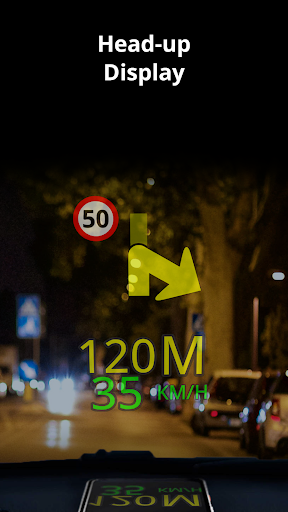
• Stay safe with the free Head-up Display (HUD) feature which projects the most important navigation info onto the windshield of your car.
• Know in advance which lane to take with precise turn-by-turn navigation and lane assistance.
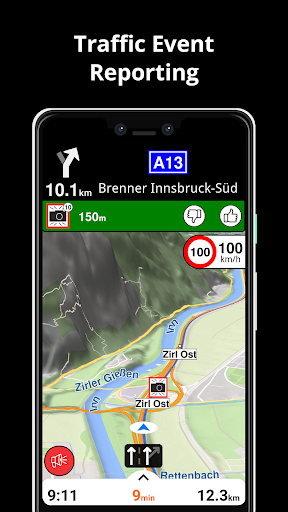
• Get notified about speed cameras and stay up to date with current speed limits.
TRAFFIC INFO
• Get real-time traffic info, updated every minute.
• Discover alternative routes that avoid the traffic jams and save you time on the road.
PUBLIC TRANSPORT
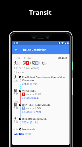
• Get around town quickly and easily. Choose from public transit routes that combine all transportation modes: bus / metro / subway / light rail / train / ferry
• Get walking directions, transfer times, departure times, number of stops. And when available, the cost.
• Find wheelchair or bike friendly public transportation.
WEATHER
• View current temperature and local weather forecast for your favorite locations.
• See what weather conditions to expect in the next hours and view the forecast for the next 10 days.
NOTES:
* Some features are not available in all countries.
* Some features require internet connection.
Downloads
1.2.3.4.5.6.7.8.9.0
LATEST
12/22/2023
Download
102 MB
1.2.3.4.5.6.7.8.9.0
LATEST12/22/2023
Supported Architectures
MD5 Checksum
aabe187934b184f3a09a9cfaff1093fe
Minimum SDK Version
26
Version Code
2023161936
Upload Date
Dec 22, 2023, 8:50:21 AM
1.2.3.4.5.6.7.8.9.0
12/09/2022
Download
51.66 MB
1.2.3.4.5.6.7.8.9.0
12/09/2022
Supported Architectures
MD5 Checksum
76b66da8993057eda75d2c0a8b592201
Minimum SDK Version
16
Version Code
2022112581
Upload Date
Dec 9, 2022, 3:23:10 AM
1.2.3.4.5.6.7.8.9.0
06/25/2022
Download
49.77 MB
1.2.3.4.5.6.7.8.9.0
06/25/2022
Supported Architectures
MD5 Checksum
a51e5dfc2681f7a97d6b2a01f7473f89
Minimum SDK Version
16
Version Code
2022062438
Upload Date
Jun 25, 2022, 6:41:07 AM
Similar Apps
cleVVVer mobil
5.0
everyone
Transit Now Toronto for TTC +
5.0
everyone
SeaPeople
5.0
teen
Yellow Cab Lake Charles
5.0
everyone
Waymo One
4.9
everyone
GPS Speedometer Car DashCam
4.9
everyone
BusBahnBim
4.9
everyone
Transfix
4.9
everyone
TripShot
4.8
everyone
Citymapper
4.8
everyone